Soil Zones of Alberta (1945) Accession No: 19881001003
Soil Zones of Alberta (1945) Accession No: 19881001003
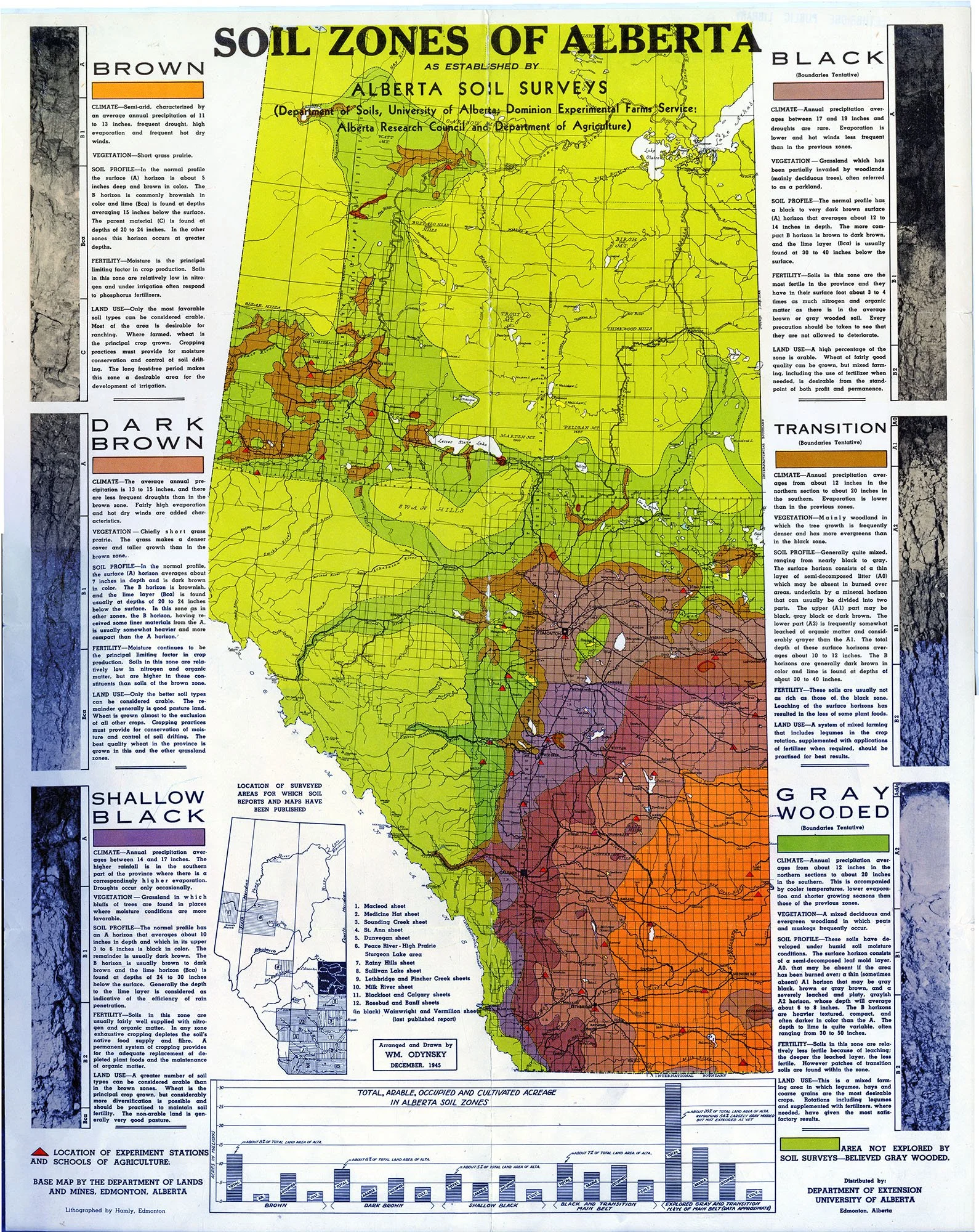
The map shows all of Alberta with each soil type colour-coded: Brown, Dark Brown, Shallow Black, Black (Boundaries Tentative), Transition (Boundaries Tentative), and Grey Wooded (Boundaries Tentative). Area not explored by Soil Surveys - believed Grey Wooded. The locations of Experiment Stations and Schools of Agriculture are marked with a red triangle. Base map by the Department of Lands and Mines, Edmonton, Alberta. Descriptive notes and illustrations are printed on the left and right margins. A table entitled "Total, Arable, Occupied, and Cultivated Acreage in Alberta Soil Zones" is at the bottom of the map—acres in millions. Black/White insert map shows the location of surveyed areas for which soil reports and maps have been published. 1. Macleod sheet, 2. Medicine Hat sheet, 3. Sounding Creek sheet, 4. St. Ann sheet, 5. Dunvegan sheet, 6. Peace River - High Prairie Sturgeon Lake area, 7. Rainy Hills sheet, 8. Sullivan Lake sheet, 9. Lethbridge and Pincher Creek sheets, 10. Milk River sheet, 11. Blackfoot and Calgary sheets, 12. Rosebud and Banff sheets and (in black) Wainwright and Vermilion sheets (last published report).
The information on this page can be used for science or social studies when teaching about the geography of Alberta.